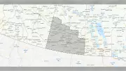
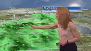
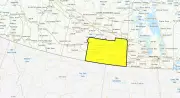
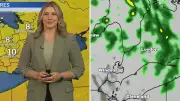
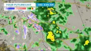
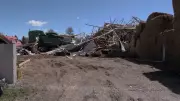
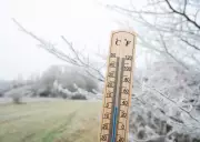
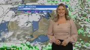
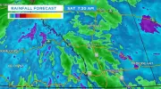
Canada Faces Widespread Cold and Snow Warnings
Environment Canada issues extensive cold and snow warnings across the country, impacting travel and daily life. Authorities urge caution as frigid conditions persist.
London, Ontario faces continued snowfall Thursday with Environment Canada forecasting a very cold and snow-packed weekend. Residents are advised to prepare for hazardous winter conditions.
The Greater Toronto Area faces a severe winter storm this weekend with up to 30 cm of snow and temperatures plunging to -40°C due to a polar vortex. The system originates from a major U.S. storm affecting millions.
Environment Canada has issued a snow squall watch for Montreal with heavy flurries reducing visibility. Arctic air will bring temperatures dropping to -25°C with dangerous wind chills approaching -40°C by weekend.
Environment Canada maintains snow squall warnings for several Ontario areas, including Sudbury and Sault Ste. Marie, as hazardous winter conditions persist across the province.
Residents in Windsor-Essex are preparing for a harsh winter weekend as Environment Canada issues warnings for bitter cold temperatures and blowing snow, with significant impacts expected on travel and daily activities.
Meteorologists explain the difference between an Arctic intrusion and polar vortex as Toronto faces extended cold, with snowfall warnings and impacts across the GTA.
Calgary residents should prepare for a sharp return to winter conditions as temperatures are forecast to drop significantly throughout Thursday, accompanied by periods of on-and-off snow and potential squalls.
The snowfall warning for London has ended, but residents should expect continued flurries and blowing snow. CTV London Meteorologist Julie Atchison provides the full forecast.
Southern Saskatchewan faces reduced visibility due to high winds and blowing snow, with forecasts warning of hazardous conditions. Other national news includes health recalls and political developments.
Environment Canada has issued cold and blowing snow advisories across much of Saskatchewan as frigid temperatures and dangerous wind chills create hazardous winter conditions.
Environment Canada issues widespread cold warnings across Manitoba as temperatures plummet and wind chills create hazardous conditions for residents.
Midwestern Ontario communities are experiencing a significant increase in snow days this winter, disrupting transportation and daily life as heavy snowfall continues to batter the region.
Montreal has opened 534 additional warming centre spots ahead of a polar vortex bringing extreme cold, with officials expressing confidence in resources for unhoused residents.
A snowfall warning has been issued for parts of Waterloo Region, North Dumfries, Perth County, and Brant County, with blowing snow and hazardous conditions expected.
Toronto and the GTA are under a winter weather alert, with up to 10 cm of snow and bitterly cold wind chills expected. Residents should prepare for hazardous travel conditions.
Intense snow squalls have led to the closure of Highway 11 near Gravenhurst, Ontario, creating dangerous driving conditions across the Muskoka area as a winter storm impacts the region.
The yellow snowfall warning for Toronto has ended after an Alberta Clipper brought significant snow, causing a messy afternoon commute. Other national news includes political, sports, and environmental updates.
Meteorologist Colleen Bready forecasts a severe cold snap descending over Manitoba, with temperatures plummeting significantly across the province in late January.
A significant snowfall warning remains in effect for London-Middlesex, with hazardous conditions impacting travel and daily activities across southwestern Ontario.
The City of Edmonton has triggered its extreme weather response, opening additional shelter spaces as a prolonged cold snap brings dangerous temperatures to the region through the weekend.
A messy afternoon commute unfolds in Toronto as an Alberta Clipper weather system dumps significant snow across the Greater Toronto Area, causing travel delays and hazardous conditions.
Calgary and southern Alberta are set for a dramatic cooldown, with Wednesday's lows becoming Thursday's highs. The region faces frigid conditions and potential snow by Friday, according to the latest forecast.
Edmonton has activated its extreme weather response protocol as temperatures are forecast to plummet below -20°C for at least a week, with expanded shelter services and warming facilities available.
A major winter storm is forecast to bring devastating ice accumulations across the Southern U.S. from Texas to the Carolinas this weekend, threatening widespread power outages and travel disruptions.
Environment Canada has prolonged a fog advisory for Metro Vancouver and parts of Vancouver Island, warning of reduced visibility and potential travel disruptions.
Meteorologists warn Ontario will experience the planet's coldest air mass this Friday, with temperatures plummeting to -50°C at mid-levels. The polar vortex shift could bring extreme cold lasting through February.
Environment Canada has issued snow squall warnings for Sudbury and Sault Ste. Marie, with heavy snow and reduced visibility expected. CTV's Rick Wyman provides the seven-day forecast for northeastern Ontario.
Edmonton residents should prepare for a sharp cold snap as temperatures are forecast to plummet by 20 degrees Celsius in the coming days, bringing frigid conditions back to the region.
Environment Canada issues a snowfall warning for parts of the Greater Toronto Area as an Alberta Clipper system moves in, creating potentially hazardous conditions for the Tuesday morning rush hour commute.