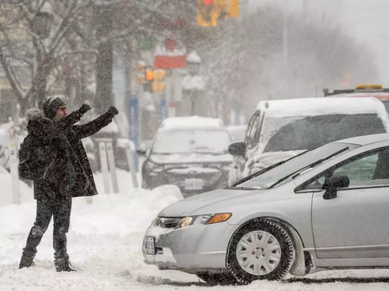
Toronto Area Prepares for Significant Winter Weather Event
The Greater Toronto Area is bracing for the impacts of a major winter storm system that is expected to bring substantial snowfall and dangerously cold temperatures this weekend. According to meteorological reports, the region could see up to 30 centimetres of snow accumulation on Sunday, accompanied by frigid conditions that may drop to as low as -40°C.
Storm System Origins and Projected Path
This significant weather event originates from a large-scale storm developing over the United States. The system is forecast to affect a massive 3,200-kilometre stretch from the Southern Plains and Southwest to the East Coast, beginning on Friday. As it moves northward throughout the weekend, the northern portion of this storm is predicted to reach southern Ontario, bringing winter precipitation to the GTA.
Winter storm watches are already in effect across a 2,700-kilometre corridor in the United States, extending from eastern Arizona through Virginia and North Carolina, reaching up to southern New England. The southern regions of this system will experience freezing rain and crippling ice accumulation, while an Arctic airmass brings widespread temperatures between -12°C and -6°C to affected areas.

Timing and Peak Intensity
The storm is expected to reach its peak intensity on Sunday, when approximately 55% of the United States population will simultaneously experience some form of winter precipitation—whether snow, sleet, or freezing rain. For the Toronto area, the most significant impacts are anticipated on Sunday as well, with the heaviest snowfall occurring during this period.
Meteorologists note that many details about the storm remain uncertain since the system is not likely to fully form until late Friday. The Weather Network explains that this major winter event will develop as moisture, energy, and milder air from both the Pacific Ocean and Gulf of Mexico interact with cold winter air, creating the extensive weather system that will spread across the southern United States before moving northward.
Extreme Cold and Polar Vortex Influence
Beyond the substantial snowfall, the Greater Toronto Area faces an additional weather challenge from a polar vortex that will bring subzero temperatures throughout the weekend. The combination of heavy snow and extreme cold creates particularly hazardous conditions for residents, potentially affecting transportation, infrastructure, and public safety.
This weather pattern represents a significant winter event for the region, with the potential for disruptive snowfall amounts and dangerously low temperatures that warrant careful preparation by both municipal authorities and individual residents.