Environment Canada has issued a severe thunderstorm watch for southern Ontario, particularly for communities west of Ottawa, including Bancroft, Kaladar, Pembroke, and areas from Midland southwest toward Sarnia. The warning is in effect late this afternoon and into the evening.
Severe Weather Risks
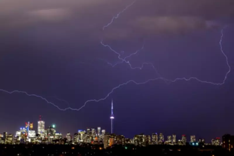
Tuesday's severe weather risk brings the potential for strong winds, large hail, lightning, and even a tornado. Forecasters predict the strongest conditions in the aforementioned regions, with the storms expected to weaken as they approach Toronto and the Golden Horseshoe.
Currently, Toronto is under a slight to strong risk of severe weather. Thunderstorms are anticipated during the late afternoon and early evening. Residents should be cautious of wind gusts exceeding 100 km/h and hail the size of ping-pong balls. The stormy weather is expected to subside later in the evening, likely between 9 p.m. and 10 p.m., as the lack of daytime heat reduces the intensity of the thunderstorms.

Cold Front to Follow
After the storms, a cold front will move into southern Ontario overnight, ending the province's first major heat event of the year. By Wednesday, some Ontarians may wake up to single-digit temperatures. There is even a risk of frost in parts of central Ontario as the cooler air settles in.
Toronto experienced an unusually early heatwave over the holiday weekend and into early this week, with temperatures reaching 30°C and humidity making it feel like 35°C. Environment Canada had issued a yellow heat warning for the province, stretching from Windsor and Niagara through the GTA to Collingwood.