A significant atmospheric river event is drenching British Columbia's South Coast, prompting official flood warnings for parts of Vancouver Island. The heavy rainfall, which began over the weekend, has raised concerns about river levels and potential flooding in vulnerable areas.
Official Warnings and Immediate Risks
Environment and Climate Change Canada has maintained rainfall warnings for the region, with particular focus on eastern Vancouver Island. The River Forecast Centre has escalated its alert to a flood warning for specific watersheds on the island that are most susceptible to rapid rises. Forecasters predict that the persistent, heavy rain could lead to minor flooding in low-lying areas and pose risks near riverbanks and culverts.
Meteorologists attribute the deluge to an atmospheric river, a long, narrow band of concentrated moisture moving in from the Pacific Ocean. These weather systems are known for transporting massive amounts of water vapour and can lead to extreme precipitation events, especially when they encounter coastal mountain ranges.

Regional Impact and Public Advisories
The downpour is affecting a wide swath of the South Coast, including the Greater Vancouver area. While the flood warning is specifically targeted at Vancouver Island, authorities across the mainland are also advising caution. Local governments and emergency officials are urging residents to take proactive steps.
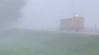
Residents in flood-prone zones are being told to prepare emergency kits and have a plan in place. Drivers are warned to avoid crossing flooded roadways and to be mindful of potential debris flows or landslides, especially along highway corridors and forest service roads. The public is advised to stay clear of fast-flowing rivers and potentially unstable riverbanks during this period of heightened risk.
Context and Ongoing Monitoring
This event echoes previous heavy rainstorms that have tested the region's infrastructure and emergency response capabilities. The River Forecast Centre and other agencies are closely monitoring river levels, rainfall totals, and weather models around the clock. Updates to warnings and advisories are expected as the storm system evolves and moves through the region.
The situation underscores the increasing frequency and intensity of precipitation events linked to broader climate patterns. Officials emphasize that public vigilance and preparedness are key to managing the risks associated with such severe weather. Residents should continue to monitor local news and official channels for the latest information on road closures, school impacts, and any evacuation orders or alerts that may be issued.