Residents of southern Alberta are in for another day of unseasonably mild conditions, as the warm spell that began earlier this week is set to persist. Tuesday's forecast mirrors Monday's weather, featuring above-average temperatures and gusty winds that are accelerating the melting of seasonal snowpack.
Detailed Forecast for Southern Alberta
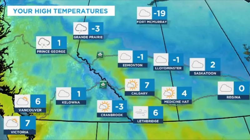
According to the latest meteorological data, Tuesday will see daytime highs reaching the mid-single digits across the region. Perhaps more striking is the predicted overnight low, which is expected to be warmer than the average daily high for this time of year. This significant temperature anomaly is driven by a strong flow of Pacific air.
Accompanying the warm air are strong west winds, which are expected to continue through Wednesday. These winds not only contribute to the rapid thaw but can also lead to localized blowing snow in areas where cover remains, and may create challenging driving conditions on exposed highways.

Context and Regional Impacts
This persistent warm interlude in late December is a notable departure from typical winter weather for Calgary and surrounding communities. The consistent above-freezing temperatures are causing widespread melting of snow and ice. While the break from deep cold may be welcome for some, it presents challenges such as:
- Increased runoff and potential for pooling water on roads and walkways as ice dams clear.
- Icy conditions during the evening and early morning as melted snow refreezes.
- Variable driving conditions with wet roads and reduced visibility in blowing snow.
The weather system responsible for this pattern is broad, affecting much of Western Canada. While southern Alberta experiences warmth, other parts of the country are dealing with starkly different conditions, including winter storms and extreme cold, highlighting Canada's diverse climate.
Looking Ahead
The forecast indicates that this warming trend will hold steady through Wednesday. Residents should enjoy the mild spell while preparing for the eventual return of more seasonal winter temperatures, which are typical for early January. The rapid melt can lead to slippery conditions, so caution is advised on sidewalks and roads, especially during overnight hours when surfaces may freeze.
Environment Canada and local authorities recommend staying updated on the latest forecasts, as conditions can change rapidly. Drivers are particularly advised to be mindful of potentially slippery patches and adjust their speed accordingly during this period of significant thaw.