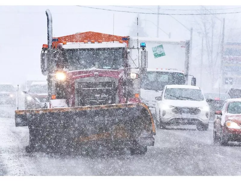
A potent winter storm has prompted authorities across Windsor and Essex County to issue urgent warnings to drivers and cancel all school board transportation for Thursday, January 15, 2026. Police are responding to a high volume of collisions as snow-covered, icy roads create dangerous travel conditions.
Police Plea for Safe Driving Amid Hazardous Conditions
Both the Ontario Provincial Police (OPP) West Region and Windsor Police Service have taken to social media and public alerts, imploring motorists to exercise extreme caution. "Snow covered roadways are slick, slippery and ice covered," stated the OPP. They emphasized that drivers are facing significant visibility issues and must slow down, adjusting their speed to the treacherous road and weather conditions.
Windsor police reported responding to numerous collision-related calls overnight. Officials reiterated the need for increased following distance, reduced speed, and adapted driving behaviour to match the unpredictable environment. The persistent storm has led to road closures and continuing hazards, with police suggesting residents avoid any non-essential travel.

Municipal Responses and Local Impacts
Local municipalities have activated their winter response protocols. The Municipality of Lakeshore warned drivers about high winds causing blowing snow, which leads to drifting and reduced visibility, a concern expected to last into the weekend. To aid snow clearing, officials asked residents to move parked cars off local streets whenever possible.
In Kingsville, the situation escalated to the declaration of a significant weather event. This declaration means all town-maintained roads and sidewalks are officially considered to be in a state of repair, lowering the standard for immediate clearing. The town urged drivers and pedestrians to use a high level of caution and avoid unnecessary trips. An on-street parking ban for snow removal is in effect, with a $35 fine for violations. Free municipal parking lots are offered as an alternative.
Ongoing Weather Forecast and Travel Disruptions
Environment Canada indicated that while snow flurries were expected to end Thursday morning, northwest winds reaching 20 km/h with gusts up to 40 km/h would continue. Temperatures held steady near minus 8 degrees Celsius, with a biting wind chill making it feel like minus 17 in the morning and minus 12 in the afternoon.
The forecast calls for more snow, with a 60 percent chance overnight into Friday and an additional 2 to 4 centimetres expected on Friday itself. Southwest winds of 30 km/h will persist, with temperatures ranging from a high of minus 1 to a low of minus 3. The combination of ongoing precipitation and wind ensures that hazardous conditions will likely continue, affecting the weekend.
Major transportation routes were also impacted, with a lane reduction reported on Highway 401 westbound at Highway 77 (Comber) early Thursday. The collective message from all emergency and municipal services remains clear: safety first. With school buses cancelled and roads perilous, the best course of action is to stay home if you can.