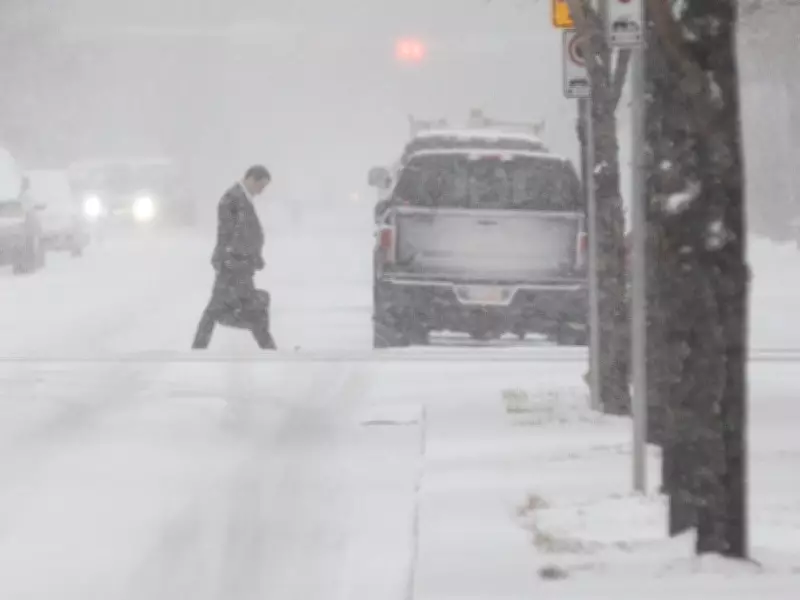
Snowy conditions are expected to return to the Calgary region through Saturday, with localized heavy precipitation. A recent stretch of deceptively pleasant weather will give way to a rapidly deteriorating one, as a forecast heavy snow dump will obscure visibility in some places from Thursday night through Saturday morning, according to Environment Canada.
Travel Conditions to Deteriorate Quickly
“Prepare for quickly changing and deteriorating travel conditions,” reads a statement from the agency. Some areas around the city might receive accumulations of 10 centimetres, while other areas might not, says Christy Climenhaga, scientist at Environment Canada.
“It will likely be more localized … and it’s really hard to pin down exactly where these bands of snow will pop up. So the best chance for these bands of snow to develop is around the Drumheller-Stettler area,” she said. “But there could also be some setup from around Sundre and then over the city. We’ll have to see exactly where.”

Contrast with Eastern Regions
Climenhaga said the weather system developing over the Calgary area brings rapidly changing conditions, in contrast to regions in the east, including Northern Saskatchewan and northern Manitoba, where snow is more widespread.
Outlook for Next Week
The weather is forecast to stabilize after next week, with temperatures reaching 13C. “Next week looks a little bit quieter in terms of snowfall,” Climenhaga said. “Temperature-wise, we’ll see a return to normal as we make our way into next week.”
Calgary Experiencing All Four Seasons in One Week
The potential flurry comes after wide swings in the city’s weather. Temperatures skyrocketed to 23C on Tuesday before falling to the single digits, taking Calgarians through all seasons in the same week. Last week, a spring snowstorm blanketed the city with up to 30 centimetres of snow in some areas, though the official tally, measured at the airport, recorded 6.8 centimetres. The storm contributed to more than 100 collisions and resulted in multiple road closures.
April Snowfall Exceeds Average
April 2026 has already surpassed April 2025 for total snow accumulation. The average snowfall in Calgary for the month is 22.9 centimetres — the city has measured 30.8 centimetres so far, making April the second-snowiest month of the year behind March. But while this month’s snowfall is on the upper end of the scale, it remains far from the record for April — 65.8 centimetres in 2008.
“People have a bit of recency bias,” said Terri Lang, meteorologist with Environment Canada, in a recent interview, noting that April 2025 only saw 11.2 centimetres of snow. The city is also seeing above-average temperatures for the month. The average temperature for April 21 is around 11 C, with the same day in 2026 expected to reach 23 C. The record high for the same day is 26.1 C, set in 1906.