
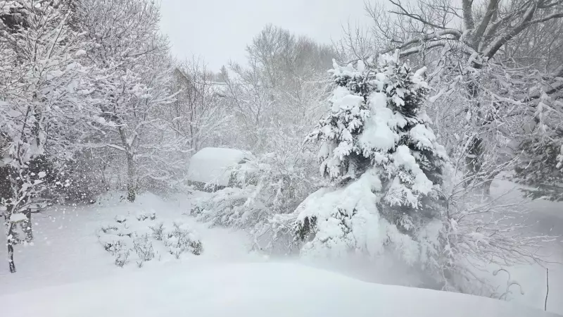
A significant shift in weather is on the horizon for Canada's Maritime provinces, with a cold front poised to deliver a wintry blast. The system is expected to arrive on Thursday, December 4, 2025, bringing with it the risk of snow squalls and a dramatic plunge in temperatures.
Timeline and Immediate Impacts
The leading edge of the cold front will push into the region throughout Thursday. Residents should prepare for periods of flurries and the potential for more intense, localized snow squall conditions. These squalls can rapidly reduce visibility and lead to sudden accumulations of snow on roads, creating hazardous travel conditions.
Behind the front, the real story will be the air mass moving in. A surge of bitterly cold polar air will follow closely, setting the stage for a sharp and sustained temperature drop. This frigid air will firmly establish itself across the Maritimes as Thursday progresses into the evening and overnight hours.

Extended Forecast and Broader Context
This incoming Arctic blast is part of an unsettled weather pattern affecting Eastern Canada. The forecast indicates that the cold and active conditions may persist, with more snow expected by Friday. This pattern aligns with other weather events across the country, such as the snow squalls blasting northeastern Ontario, which have already triggered official weather alerts.
While the Maritimes prepares for this wintry onslaught, other parts of Canada are experiencing different extremes. For instance, Edmonton is seeing a brief return of mild air, though forecasts suggest it will be gone by the weekend, highlighting the dynamic and contrasting nature of Canadian weather systems in early December.
Staying Safe and Informed
With the threat of snow squalls and rapidly falling temperatures, residents across Nova Scotia, New Brunswick, and Prince Edward Island are advised to monitor updated forecasts closely. Key precautions include:
- Adjusting travel plans for Thursday and Friday, allowing extra time for commutes.
- Ensuring vehicles are prepared for winter driving conditions.
- Taking steps to protect pets, plants, and property from the impending deep cold.
This early-season cold snap serves as a potent reminder that winter has firmly arrived in Atlantic Canada. Staying informed through official weather sources is the best defense against the unpredictable and often severe conditions that systems like this Thursday's cold front can bring.


