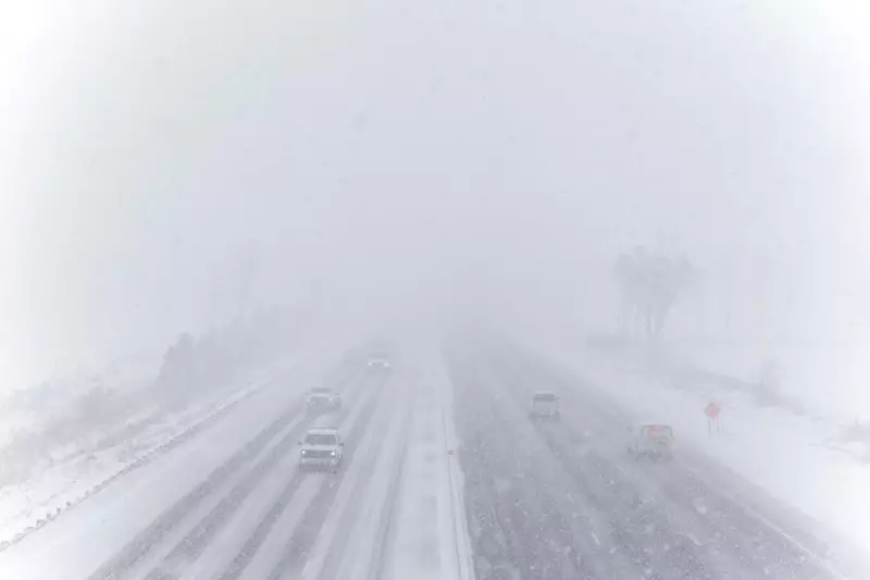
Major Winter Storm Paralyzes Parts of Ontario
A powerful winter system has unleashed its fury across Ontario, dumping staggering amounts of snow that reached up to 70 centimetres in some regions. The intense snowfall began on Friday, November 28, 2025, creating hazardous conditions and significantly disrupting transportation networks throughout the province.
Transportation Gridlock and Dangerous Conditions
The storm's impact became dramatically visible along Highway 400 at the Line 6 overpass in Innisfil, where traffic crawled through accumulating snow. Photographic evidence captured by The Canadian Press shows vehicles struggling to maintain momentum as the winter wallop intensified throughout the day.
Meteorologists indicate this significant weather event represents one of the earliest major snowfalls of the season, catching many residents unprepared for such extreme conditions. The timing proved particularly challenging for holiday travelers and commuters attempting to navigate the suddenly treacherous roadways.
Extended Weather Advisory
Weather officials have issued continued warnings as the system shows little sign of immediate departure. Forecast models suggest the winter storm will linger into the weekend, with additional accumulation potentially reaching 60 centimetres in some areas before conditions finally improve.
The prolonged nature of this weather event has raised concerns among emergency services and transportation authorities. Police departments across affected regions have urged residents to avoid unnecessary travel and prepare for potential power outages as the heavy, wet snow continues to accumulate on trees and power lines.
This early-season extreme weather serves as a stark reminder that Canadian winters can arrive with sudden intensity. Environment Canada continues to monitor the situation closely and will provide updates as the storm system evolves over the coming days.


