A powerful and moisture-laden weather system is taking aim at southern British Columbia, promising to deliver a significant dose of winter havoc to the province's critical highway network. Meteorologists are warning residents of hazardous travel conditions as a so-called "Mango Express" atmospheric river prepares to sweep across the region.
Storm Timeline and Expected Impacts
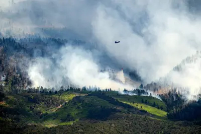
According to The Weather Network, the intense atmospheric river began with heavy rain on Sunday, December 7, 2025, before a brief respite. The system is forecast to intensify significantly throughout Monday and Tuesday, bringing rounds of heavy precipitation. Meteorologist Nadine Powell explained that this river of moisture is tapping into unusual sources, stating it is "amplified by an atmospheric river tapping into moisture from Southeast Asia."
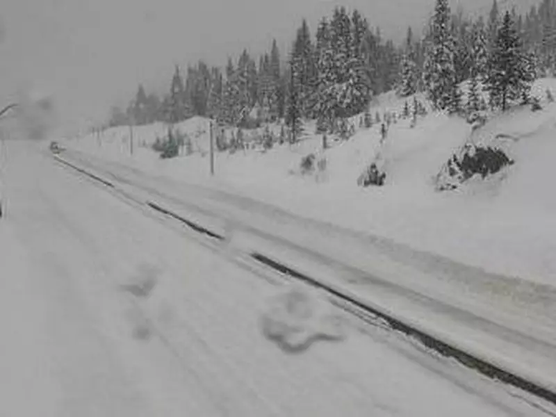
While river levels are expected to rise, the immediate and most widespread hazard is expected to be from heavy snowfall at higher elevations, directly impacting mountain passes and inland routes. "The bigger hazard will be due to snowfall with travel," Powell emphasized.

Major Highways in the Crosshairs
Several key transportation corridors are bracing for major snowfall accumulations. The Coquihalla Highway (Highway 5) from Hope to Kamloops is forecast to receive up to 50 centimetres of snow in its higher sections by Tuesday. Similarly, the Allison Pass in Manning Park, on the route between Hope and Princeton, is expected to be just as treacherous with comparable snowfall levels.
The precipitation won't be confined to the coast. The system is predicted to push inland as far as the Rocky Mountains, with the Kootenay, Columbia, and Rockies regions potentially seeing up to 40 cm of snow. On the coast, Environment Canada has issued a rainfall warning for the Sea-to-Sky corridor, with up to 70 millimetres of rain forecast near Squamish and Whistler by Monday morning, leading to potential pooling water and reduced visibility.
Unusual 'Mango Express' and Flooding Concerns
This atmospheric river is notable for its origin. Pacific Northwest Weather Watch commentator Michael Snyder noted that because it is developing so far west, it is being called a "mango express," a twist on the more common "pineapple express" that typically draws moisture from near Hawaii.
The heavy rain associated with the system is predicted to hit the U.S. Pacific Northwest hardest. However, this raises concerns in Metro Vancouver due to the precedent set in November 2021, when catastrophic flooding in the Sumas Prairie was caused by the overflow of Washington State's Nooksack River. As of 7 p.m. on Sunday, December 7, the B.C. River Forecast Centre had not issued any flood warnings or advisories.
Authorities are urging extreme caution. DriveBC and other agencies advise motorists to "watch for hazardous, slippery travel" and to allow extra time for any journeys through affected regions. As of 7:30 p.m. Sunday, no formal travel advisories were posted, but conditions are expected to deteriorate rapidly. The storm also delays winter sports, as none of Metro Vancouver's North Shore ski hills have opened for the season, though Whistler Blackcomb opened with limited terrain on November 21.