Environment Canada Forecasts Brief Thaw Before Return of Arctic Air in February
After enduring a prolonged period of bone-chilling cold, Canadians across southern Ontario are about to get a welcome, albeit temporary, reprieve. According to Environment Canada meteorologist Geoff Coulson, the frigid temperatures that have gripped the region are finally set to wind down, offering a brief spell of seasonal to warmer-than-seasonal conditions.
A Temporary Respite from the Deep Freeze
"Monday is the final day of this particular cold spell," Coulson explained in an interview with the Toronto Sun. "For the rest of this week and into early next week, we are looking at a shift to more seasonal or even slightly warmer-than-seasonal temperatures."
This shift will be a noticeable change for residents who have been battling sub-zero conditions. The forecast indicates that Tuesday afternoon could see a high of 1°C, which, with the wind chill factored in, will feel like -4°C. While still brisk, this marks the first day above the freezing point since January 17th.

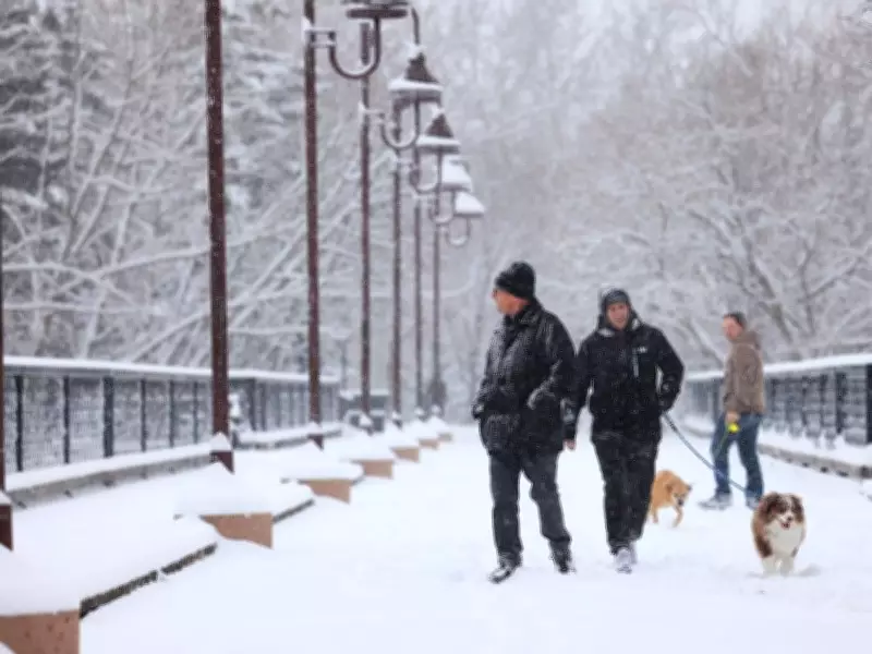
Coulson pointed out some positive aspects during this cold snap, including an unusual amount of sunshine for this time of year. "We have received surprising doses of sunshine, which is not something we necessarily see all that often during these periods," he noted. Typically, seasonal temperatures bring greyer skies and a higher chance of mixed precipitation like freezing rain.
Winter's Grip Remains Firm
However, this milder interlude comes with a significant caveat. The relief is expected to be short-lived. Coulson warned that by approximately February 21st or 22nd, another shot of arctic air will descend from the north, pushing temperatures back below seasonal norms as the month concludes.
"It appears we will wrap up the month on the cold side again," Coulson stated. "This is not a surprise. February is traditionally our second-coldest month, and there is lots more winter left to go."
For the Toronto area, historical data shows the long-term normal daytime high for this period is -1°C, with overnight lows typically dropping to -9°C. The impending return to cold aligns with these seasonal expectations.
Potential for Messy Commuting Conditions
As temperatures moderate in the coming days, the meteorological conditions also shift, increasing the likelihood of messy weather. Coulson advised residents to stay alert for potential mixed precipitation, including rain-snow mixes and freezing rain, which could create hazardous travel conditions.
Specifically, the transition on Monday into Tuesday may impact commuters. Light snow is forecasted overnight and into Tuesday afternoon, with an expected accumulation of 2 to 4 centimetres across the Greater Toronto Area. While Coulson assured that no significant build-up is anticipated, the combination of snow and fluctuating temperatures could slow the Tuesday morning commute.
"We have a system moving through northern Ontario that will give a little bit of snow generally across the GTA," he said. "It should taper off by Tuesday morning."
This weather pattern serves as a reminder that while brief thaws offer relief, the heart of winter still holds considerable sway over Canadian weather well into February, with residents advised to prepare for continued cold and variable conditions.