Tropical Storm Arthur, the first named storm of the Atlantic hurricane season, is barreling toward the Gulf Coast, threatening to unleash heavy rainfall across the region. The storm, which formed earlier this week, is expected to make landfall along the Texas coast, bringing with it the potential for flash flooding and gusty winds.
Storm Formation and Path
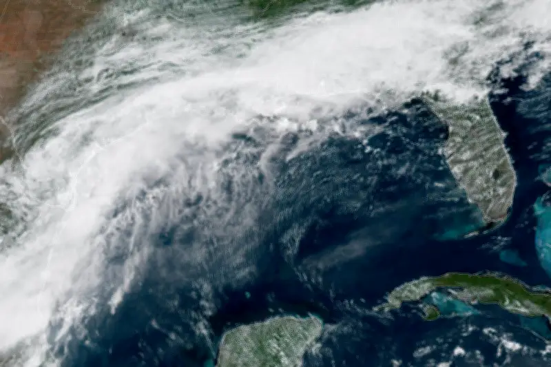
According to the National Oceanic and Atmospheric Administration (NOAA), the storm system began organizing over the Gulf of Mexico on Tuesday, June 16. Satellite imagery from NOAA's GOES-19 satellite showed a well-defined circulation center with deep convection near the Texas coast. The storm is forecast to move inland over the next 24 to 48 hours, bringing heavy rain to areas from Corpus Christi to Houston.
Expected Impacts
Meteorologists are warning that the storm could produce rainfall totals of 4 to 8 inches, with isolated amounts up to 12 inches in some areas. This could lead to significant flash flooding, especially in low-lying and urban areas. In addition to the rain, the storm is expected to bring tropical storm-force winds, with gusts up to 50 mph, which could cause downed trees and power outages.

Residents along the Gulf Coast are advised to monitor local weather reports and prepare for potential flooding. Emergency management officials are urging people to have emergency kits ready and to avoid driving through flooded roads.
First Storm of the Season
Tropical Storm Arthur marks the beginning of the 2026 Atlantic hurricane season, which runs from June 1 to November 30. The National Hurricane Center predicts an above-average season this year, with 17 to 21 named storms expected. Arthur is the first of what could be many storms to threaten the U.S. coast this year.
While Arthur is not expected to intensify into a hurricane, its slow movement could exacerbate the flooding risk. The storm is expected to weaken as it moves inland, but heavy rain will persist for several days.