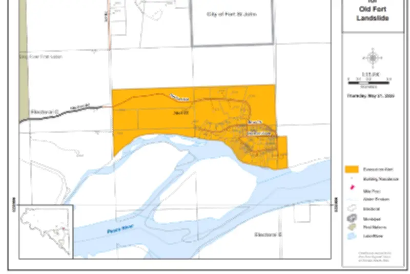
More than a century ago, the original settlement of Old Fort, situated along the Peace River just south of Fort St. John, British Columbia, was relocated to its current site. Today, the original location, still known as Old Fort, continues to house residents and maintain a community. However, the high riverbanks are steadily crumbling and falling back into the river, impacting housing, infrastructure, roads, and access.
Last month, Peace River Regional District officials issued evacuation alerts for several properties in the Old Fort area due to landslide activity, advising residents to be ready to leave on short notice. The recurring landslides have reignited concerns about public safety, infrastructure, road access, emergency planning, property rights, and the long-term viability of homes in this geologically active region.
Provincial Response to Landslide Concerns
A series of questions were directed to the government of British Columbia regarding riverbank erosion along the Peace River and the natural processes behind it. Three provincial ministries provided responses: the Ministry of Transportation and Transit regarding Old Fort Road, the Ministry of Water, Land and Resource Stewardship on landslide management, and the Ministry of Emergency Management and Climate Readiness on community properties.

Question: Riverbank erosion is a constant, known geological process. The riverbanks will always retreat due to erosion and gravity. What exactly is being investigated that is not already understood?
Answer from the Ministry of Transportation and Transit: The ministry acknowledges the challenging situation for Old Fort residents and prioritizes maintaining access to their community. The slide affecting Old Fort Road is a large, complex, deep-seated landslide, approximately 400 meters wide, previously active in 2018 and 2020. Current movement is attributed to a combination of factors, including geological conditions and water runoff, with no observed riverbank erosion or river influence on the current slide.
Question: At what point does calling this an “event” obscure the fact that this is an ongoing, predictable land loss driven by gravity and river flow?
Answer from the Ministry of Transportation and Transit: Staff continue to monitor slide conditions. Movement has decreased significantly, and once conditions permit, work will begin to restore temporary access to the community.
Question: How much public money and time is being spent studying a process that residents seem to ignore, but geologists recognize as continuous shoreline retreat?
The response emphasized that the ministry is focused on safety and access, but specific cost figures were not provided.
Local Leadership in Relocation Decisions
Local governments and First Nations are taking the lead in decisions to relocate people, buildings, and infrastructure from high-risk areas, as well as managing property acquisition. The situation in Old Fort highlights the challenges of living in geologically active zones and the need for long-term planning to address erosion and landslide risks.