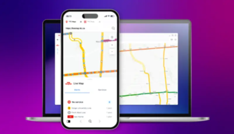
The TTC has published an interactive Live Map on its website with the goal of helping customers navigate the system with greater confidence and real-time awareness, according to a news release from the transit commission on Monday.
Real-Time Subway and LRT Information
The map provides a clear, interactive view of subway and light rail transit (LRT) service across the network. Bus and streetcar routes will be added in a future update, targeted for release later this year.
Phased Rollout and Customer Feedback
The TTC is releasing the interactive map in phases to gather customer feedback and refine the experience before further expansion. Customer input will be critical in helping to shape the final version of this interactive tool, the news release said.

Key Features of the Live Map
- Navigational panel: Transit users can explore service details such as real-time train and bus departures, occupancy levels, and station features.
- Map tool function: Users can learn how to navigate the map effectively.
- Location service: Enables a hand-held device to see nearby stations.
- Feedback section: Users can share their thoughts directly with the TTC’s development team.
The Live Map is compliant with the Accessibility for Ontarians with Disabilities Act (AODA).
How to Access the Map
The live map is accessible through the TTC’s website or via a dedicated webpage. To learn more about the pilot project, visit ttc.ca.