Koryx Copper Provides Update on Zambia Projects
Koryx Copper S.A. (TSX:KRY.V) (NSX:KYX) (OTCQB:KRYXF) has released an update on exploration results and progress at its two large-scale exploration licences in Zambia: the Luanshya West project (LEL 23246, 54 km²) and the Mpongwe project (LEL 23248, 675 km²). The company holds an option to acquire up to 80% of these projects, located in the Zambian Copperbelt, part of the Central African Copperbelt (CACB)—the world's largest sedimentary rock-hosted stratiform copper province, hosting at least 14 giant deposits including Kansanshi, Sentinel, Kamoa, and Kakula.
Key Highlights from Surface Geochemistry
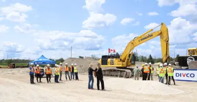
First-pass regional surface geochemical sampling over the Mpongwe licence has identified additional copper soil anomalies for follow-up, in a similar stratigraphic and structural setting to the Lwabufubu target. Repeat soil sampling results confirm Lwabufubu as a priority for further work. A drill program at Luanshya West is planned for late season 2026, and initial consent has been granted for the transfer of the two earn-in licences to Koryx Zambia.
Heye Daun, Koryx Copper’s President and CEO, commented: “While our focus remains the Haib Copper Project in Namibia, this update on our Zambian Projects shows the progress we are making by carrying out systematic exploration aimed at identifying legitimate targets for drill testing and turning over ground that is less prospective. The heavy rains in Zambia have delayed our field programmes this year, but we remain committed to advancing our projects there, particularly once we have secured the transfer of the two licences to our local subsidiary. Our next phase of work will focus on drilling at Luanshya West, while we assess surface anomalies at Mpongwe for possible drill testing later in the year.”

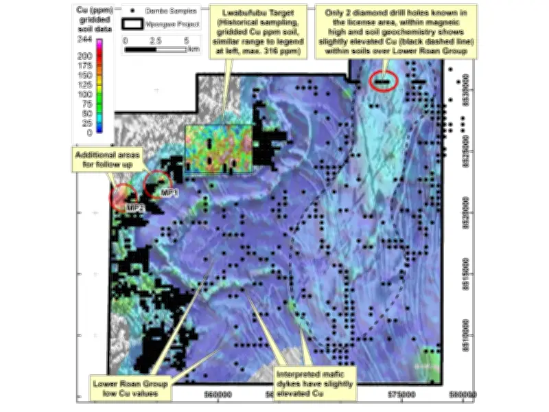
Mpongwe Project Soil Sampling Results
Results from soil sampling carried out in late 2025 have been compiled and interpreted along with historical data. A total of approximately 4,000 soil samples (excluding Quality Assurance and Quality Control samples) were collected and analysed by Inductively Coupled Plasma Optical (Atomic) Emission Spectrometry (ICP-OES) for a suite of 33 elements. The sampling was conducted with three different aims and sample spacings:
- Repeat sampling over historical soil sampling points to confirm historical surface geochemistry data, carried out on selected lines at a sample spacing of 50 m at the Lwabufubu target and the area of previous diamond drilling in the northeast of the licence.
- Regional sampling targeting interpreted Upper Roan Group rocks and the contact zone with the underlying Lower Roan Group at 250 m x 250 m sample spacing.
- Regional sampling at 500 m x 500 m spacing testing the large areas of low-lying relief and drainages interpreted as Lower Roan Group and possible shallow or sub-cropping basement lithologies.
Outcrop over the licence area is poor, and interpretations of the underlying geology have been driven by a few isolated outcrops, historical geophysical data (magnetics, radiometrics, and airborne electromagnetics), and satellite imagery. Multi-element geochemistry data from the 2025 soil sampling has augmented these interpretations and refined the understanding of the potential for copper mineralisation.