Snow-Producing Clipper System Approaches Southern Ontario
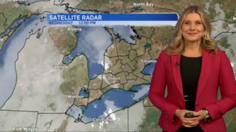
A significant snow-producing clipper system is tracking toward Southern Ontario and is expected to arrive by the end of this week, bringing additional wintry precipitation to the region. This weather event coincides with an extended period of frigid temperatures that has already gripped the area, breaking seasonal records.
Prolonged Cold Snap Sets Records
Meteorologists and climatologists note that Toronto is currently experiencing its longest cold snap in over a decade, with temperatures consistently well below seasonal averages. "We're not rushing into spring," remarked one climatologist, emphasizing the persistent nature of this Arctic air mass. The combination of the incoming clipper and existing cold conditions suggests that winter's grip will remain firm across much of the province.
Regional Weather Impacts and Forecast
The clipper system, known for its fast-moving nature, is anticipated to deliver:

- Accumulating snowfall across Southern Ontario
- Reduced visibility and potential travel disruptions
- Wind chill values that will make conditions feel even colder
Residents are advised to prepare for winter driving conditions and to monitor updated forecasts from local meteorological services. The prolonged cold has already impacted daily life, from increased energy consumption to challenges for outdoor activities and infrastructure.
Broader Weather Context Across Canada
This Ontario weather event occurs amidst varied conditions nationwide. From British Columbia to the Atlantic provinces, Canadians are navigating a range of winter phenomena. The forecast serves as a reminder of the dynamic and often severe nature of Canadian winters, particularly during late-season cold outbreaks.