
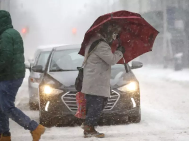
A winter weather system is sweeping through the Greater Toronto Area on Friday, bringing a mix of precipitation, rapidly changing conditions, and significant travel hazards. Environment Canada has issued a special weather statement warning residents to prepare for quickly deteriorating road conditions as temperatures fluctuate around the freezing mark.
Significant Snowfall Rates Expected
Brief but intense snowfall rates of 2 to 4 centimeters per hour are expected to begin around 10 a.m. in Toronto. While total accumulation may not be extreme, the rapid snowfall rates could quickly cover roads and highways, creating slippery and dangerous driving conditions throughout the morning commute.
"Although total snowfall amounts are not expected to be overly significant, the hourly snowfall rates may result in roads and highways becoming quickly snow covered and slippery," Environment Canada's statement emphasizes. The agency specifically warns that hazardous travel conditions are expected throughout the region.

Airport Delays and Regional Variations
Toronto Pearson International Airport is forecast to receive between 7 and 10 centimeters of snow, potentially causing significant flight delays. Travelers beginning March Break trips are advised to allow extra time and check with their airlines for updated flight information.
Snowfall amounts will vary significantly across the region:
- North and east of Toronto, including Vaughan, Markham, Richmond Hill, and Durham Region, could see 10 to 15 centimeters of snow from Friday through Saturday morning
- West of Toronto, including Mississauga, Brampton, Milton, Oakville and Burlington, may receive 5 to 8 centimeters total
- Hamilton and the Niagara Region face additional challenges with strong southwesterly winds gusting up to 60 km/h in the afternoon, strengthening to 70-90 km/h gusts in the evening
Temperature Fluctuations and Wind Chill
The precipitation is expected to transition from snow to rain showers by afternoon as temperatures rise above freezing. Toronto will see a high of 3°C on Friday, but the morning wind chill will make it feel closer to -8°C. As temperatures drop again overnight, previously wet surfaces may freeze, creating additional icy hazards on roads and sidewalks.
"Falling temperatures overnight may lead to icy roads and sidewalks," Environment Canada cautions. "Prepare for quickly changing and deteriorating travel conditions."
Wind Concerns and Extended Forecast
Winds are increasing throughout the day, with gusts expected to peak late Friday afternoon and into the evening. The combination of snow, wind, and temperature fluctuations creates particularly challenging conditions for drivers and pedestrians alike.
The snow in the GTA is expected to diminish in intensity by afternoon, but the weather system will continue to affect the region through Saturday morning. Residents are advised to exercise caution when traveling, allow extra time for commutes, and monitor updated weather forecasts throughout the day.


