Major Winter Storm Poses Severe Threat to Millions Across United States
Forecasters are warning of a potentially catastrophic winter storm system that could bring devastating ice accumulations, heavy snowfall, and widespread travel disruptions to millions of Americans from New Mexico to the Carolinas and up the Eastern Seaboard. The National Weather Service reported that approximately 100 million people were under some type of winter weather watch, warning, or advisory on Wednesday ahead of the approaching storm.
Storm Timeline and Projected Impacts
The significant weather event is expected to begin on Friday and continue through the weekend, bringing a dangerous mix of precipitation types including freezing rain, sleet, and heavy snow. An atmospheric river of moisture is projected to develop by the weekend, pulling precipitation across Texas and other Gulf Coast states before continuing across Georgia and the Carolinas and heading northeastward.
Weather service forecasters on the East Coast expressed increasing confidence that the storm will strike major metropolitan areas, with snow amounts potentially reaching a foot or more along the I-95 corridor from Washington, D.C., to Boston. In the nation's capital, forecasters from the weather service's Washington/Baltimore office warned that "the combination of heavy snow and ice alongside prolonged very cold temperatures presents a unique and significant risk to life and property across virtually the entire region."

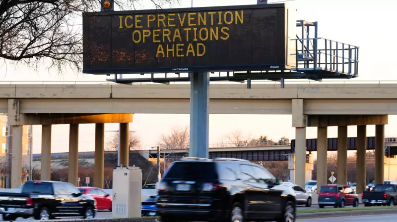
Ice Storm Threat and Infrastructure Concerns
The most concerning aspect of the storm may be the potential for crippling ice accumulations. Forecasters warn that just half an inch of ice (1.27 centimeters) can lead to devastating ice storms capable of toppling trees and power lines, creating widespread and long-lasting power outages. The latest forecasts indicate potential for a half-inch of ice or more across many areas, including parts of Arkansas, Louisiana, Alabama, and Tennessee.
Major transportation hubs face significant disruptions, with four major U.S. hub airports in the southern storm's path potentially experiencing delays: Dallas-Fort Worth, Atlanta, Memphis, Tennessee, and Charlotte, North Carolina. Additional East Coast airports could see impacts as the storm progresses.
State and Municipal Preparations
Municipalities across the storm's path are preparing their winter weather response equipment and strategies:
- Jackson, Mississippi: The city owns no traditional snowplows but uses heavy machinery like skid steers and small excavators to clear roads, along with three trucks that carry salt and sand for pre-treatment.
- Memphis, Tennessee: Operates 15 snow and ice removal trucks plus six brine-spreading vehicles. Statewide, Tennessee has 851 salt trucks and 634 brine trucks, with most salt trucks doubling as plows.
- Nashville, Tennessee: Has 45 snowplow trucks ready, including one named "Dolly Plowton" after country music legend Dolly Parton. The city added 600 miles to snowplow routes last year to reach previously unplowed neighborhood roads.
- Chicago, Illinois: Maintains 330 snowplows, 40 4x4 vehicles, and about 12 beet juice-dispensing trucks. The natural sugars in beet juice lower water's freezing point, helping salt mixtures work at lower temperatures.
- Texas: Has over 1,000 pieces of winter weather equipment including snowplows, motor graders, and brine tankers, with agency officials focusing on pre-treating roadways ahead of the storm.
- Arkansas: Has 78,000 cubic yards of salt available, distributed across 121 salt houses statewide, plus 600 salt spreaders and 700 snowplows.
Geographic Scope and Temperature Concerns
By late Wednesday, parts of at least 19 states were under winter storm watches, with more watches and warnings expected as the system approaches. The affected states include Texas, New Mexico, Oklahoma, Kansas, Missouri, Arkansas, Louisiana, Mississippi, Alabama, Georgia, Tennessee, North Carolina, South Carolina, Kentucky, Indiana, Illinois, Ohio, Virginia, and West Virginia. An estimated 55 million people are included in these winter storm watches.

Temperature will play a critical role in precipitation types. Eric Guillot, a scientist at the weather service, explained that 32 degrees Fahrenheit (0 Celsius) represents a crucial threshold. "If the temperature is slightly above 32, it will be mostly liquid. But the colder it is below the mark, the more efficiently precipitation will freeze," he noted.
Meanwhile, parts of the Northern Plains face extreme cold, with windchill values potentially reaching 50 below zero Fahrenheit (minus 45.6 Celsius) in parts of northern Minnesota and North Dakota. Nils Anderson, owner of Duluth Gear Exchange in Duluth, Minnesota, advised: "When the weather forecast says, 'feels like negative 34,' it's just a matter of covering skin and being prepared for it."
Safety Concerns and Public Advisories
Transportation professionals emphasized the seriousness of winter driving conditions. Charles Daniel, a semitrailer driver who travels across western Oklahoma where up to 12 inches of snow could fall, warned: "You've got to be very weather aware, and real smart about what you're doing. One mistake can literally kill somebody, so you have to use your head."
Experts recommend dressing in three layers for extreme cold conditions: a base layer, a middle layer, and an outer shell to maximize warmth and protection against the elements.