Environment and Climate Change Canada has issued a severe thunderstorm watch for western Manitoba, effective as of 1:49 p.m. on July 4, 2026. The watch covers a broad swath of the region, with meteorologists warning of potential large hail, damaging wind gusts, and torrential downpours that could lead to localized flooding.
Areas Under the Watch
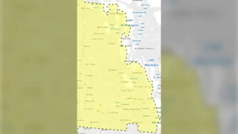
The watch includes communities such as Dauphin, Swan River, and the Duck Mountain area, where campers have been advised to evacuate on Saturday due to the heightened risk. The yellow-coded alert map, released by Environment Canada, indicates that conditions are favorable for the development of severe thunderstorms throughout the afternoon and evening.
Expected Impacts
According to Environment Canada, these storms may produce hail up to the size of golf balls, wind gusts exceeding 90 km/h, and rainfall rates of 50 mm per hour or more. Such conditions pose risks to property, including vehicles and buildings, as well as potential flash floods in low-lying areas. Residents are urged to secure loose objects, avoid outdoor activities, and stay informed through weather alerts.

Precautionary Measures
Officials recommend that individuals in the affected zones monitor local forecasts and have an emergency plan ready. In case of a warning, seeking shelter indoors away from windows is critical. The watch may be upgraded to a warning if severe weather becomes imminent.