
B.C. Residents Left in the Dark on Escalating Landslide Dangers
As climate change intensifies, British Columbia is grappling with a surge in landslide risks, particularly in regions like the Chilliwack River Valley. However, a stark information gap persists, leaving homeowners and buyers vulnerable to undisclosed geo-hazards. Unlike jurisdictions in the United States, B.C. lacks a comprehensive provincewide mapping system for natural hazards, raising critical questions about public safety and transparency.
Geological History Sets the Stage for Modern Perils
The Chilliwack River Valley's landscape was shaped approximately 11,000 years ago during the last ice age. Retreating glaciers deposited thick layers of clay, silt, sand, and gravel, with meltwater carving the river into these unstable sediments. Today, steep slopes along the north side of the river, dotted with creeks and gullies, host hundreds of homes built since 1900, many situated on precarious ground.
Drew Brayshaw, a senior hydrologist and geoscientist at Statlu Environmental Consulting, explains that these glacial materials resemble a layered cake, with strata perched on clay or gravel. When water pressure escalates—often due to heavy rainfall—the entire structure can shift. "We now have people living in areas where it may not be safe, and some of that is hindsight," Brayshaw notes, emphasizing that climate change is exacerbating landslides, floods, and other natural disasters.

Inconsistent Warnings and Legal Fallout
The Fraser Valley Regional District has taken steps by attaching geotechnical reports to its online property-mapping system since 2024. These documents detail landslide, debris flow, and flood risks for nearly 400 properties in the valley, with an assessed value of $270 million. However, about 30% of these homes face varying risks, and many residents remain unaware of the system's existence or how to access it.
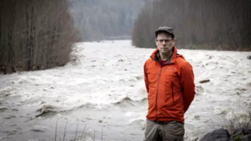
A Postmedia analysis uncovered a patchwork approach to hazard warnings. For instance, Chris Rampersad purchased a home in 2019 for $500,000, unaware of landslide risks. After heavy rains in November 2021 triggered a slide behind his property, his home was deemed unsafe, yet he received no disaster aid. Similarly, a lawsuit filed in December 2025 alleges that sellers of a property on Auchenway Road failed to disclose significant safety concerns, seeking damages for reduced market value and remediation costs.
Geotechnical reports reveal a history of instability. On Auchenway Road, at least 17 landslides have occurred in fewer than 50 years. Despite this, no restrictive covenants warning of hazards are attached to many properties' titles. The regional district states that covenants are typically only triggered during building permits or subdivisions, leaving existing homeowners without formal notifications.
Broader Implications and Calls for Action
This issue extends beyond the Chilliwack Valley, affecting areas like Metro Vancouver, the Sea to Sky corridor, and the Interior. The Insurance Bureau of Canada has advocated for a climate-scoring system for homes, similar to a credit score, to rate susceptibility to catastrophic loss. While the federal government has allocated $30 million over five years for a national home-labelling approach, initial focus remains on energy efficiency rather than hazard resilience.
In contrast, Washington state offers online geological maps with landslide susceptibility ratings, and California mandates natural hazard disclosures for property sales since 1998. B.C. has no such provincewide system or specific disclosure guidelines for hazard zones. Jason Thistlewaite, an associate professor at the University of Waterloo, criticizes this reluctance, arguing that accessible risk information is crucial and does not permanently depress housing values. "It's unconscionable that the government is not releasing this type of information," he asserts.
Ongoing Studies and Future Uncertainties
A $500,000 joint study by the Fraser Valley Regional District and the provincial government, conducted by BGC Engineering, aims to better understand slope stability risks in the Chilliwack River Valley. Expected to conclude this year, it will explore mitigation options such as early warning systems, protective works, and managed retreat through property buyouts.

However, residents like Rampersad question the efficacy of more information without concrete action. "Is the government going to use it to help protect the public?" he asks, noting that despite increased data, little has been done to assist those in unsafe situations. Brayshaw echoes this concern, stressing that market forces alone cannot resolve the crisis. "If you want to support public safety, you need to get these people in these unsafe situations some assistance to get out," he concludes.
As insured losses from natural disasters in Canada have skyrocketed from $900 million annually two decades ago to $3.7 billion today, the urgency for transparent hazard disclosure and proactive measures has never been greater. Without systemic changes, B.C. residents remain at the mercy of an increasingly volatile environment.


