Emerita Resources Corp., a mineral exploration company, has announced the launch of a significant airborne geophysical survey over its key projects in Spain's prolific Iberian Pyrite Belt. The ambitious program is set to begin in December 2025.
Uncovering Hidden Resources from the Sky
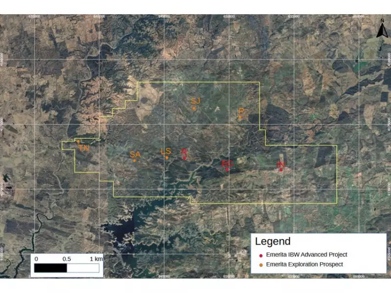
The company has commissioned a 1,536-kilometre Helicopter Time-Domain Electromagnetic and Magnetic (HTEM) survey. This advanced aerial investigation will cover the Iberian Belt West (IBW) project and the adjacent San Antonio exploration project. The primary objective is to map the electrical and magnetic properties of rocks to a depth of approximately 500 metres below the surface.
Helicopter-mounted sensors will fly lines spaced just 100 metres apart, guided by a differential GPS system for precision. The data will create a detailed subsurface profile, aiming to pinpoint zones of high conductivity often associated with valuable metallic mineral concentrations.

Strategic Focus on Known and Unknown Deposits
A key strategic element of the survey involves flying over the company's known IBW deposits—La Romanera, El Cura, and La Infanta. These areas, which are part of an ongoing mining license application, will provide definitive geophysical "signatures."
Emerita's technical team will then use these signatures as a benchmark to evaluate and prioritize anomalies detected over numerous other exploration prospects within its claim area. These include past-producing sites and untested ground with high potential for new discoveries.
Xcalibur Smart Mapping, a global leader, was selected through a competitive bidding process to conduct the survey. Meanwhile, Intelligent Exploration of Canada will handle quality assurance and interpret the final results.
Expanding the Search in a World-Class Belt
The survey area encompasses portions of the Iberian Pyrite Belt under Emerita's control, a region world-renowned for hosting massive sulphide accumulations. By applying the knowledge gained from its advanced IBW deposits to less-explored northern and southern claim areas, the company aims to efficiently identify drill-ready targets.
This method is particularly effective for finding resources that may not have clear surface expressions. Following the aerial survey, high-priority anomalies will be followed up with detailed ground work and, ultimately, drill testing to confirm discoveries.
The announcement underscores Emerita Resources' active and methodical approach to expanding its resource base in one of Europe's most significant mining districts.