Winter Storm Watch Activated for Greater Toronto Area with Significant Snowfall Expected
Environment Canada has escalated weather warnings for the Greater Toronto Area, issuing a formal winter storm watch effective immediately. Meteorological models are predicting a substantial snowfall event, with accumulations potentially reaching up to 15 centimeters across affected regions. This alert comes as a potent winter system approaches Southern Ontario, threatening to disrupt travel and daily activities.
Forecast Details and Hazardous Conditions
The national weather agency indicates that peak snowfall rates could intensify dramatically, mirroring conditions experienced in late January 2026 when Toronto saw rates of five to eight centimeters per hour. Such intensity can rapidly reduce visibility and create treacherous road surfaces. Residents are advised to prepare for rapidly changing conditions, including gusty winds that may lead to blowing snow and localized whiteout situations.
Timing and Impact: The storm is expected to move through the region beginning Monday evening, with the heaviest precipitation likely overnight into Tuesday morning. Commuters should anticipate significant delays on highways and public transit systems. School closures and business disruptions are possible depending on the storm's severity.

Municipal Preparations and Safety Recommendations
Toronto city officials have already activated their extreme weather response protocol, deploying additional snow removal equipment and staffing emergency operations centers. This proactive measure aims to mitigate the storm's impact on critical infrastructure and vulnerable populations.
Environment Canada emphasizes several safety precautions:
- Avoid non-essential travel during peak snowfall periods
- Ensure emergency kits contain supplies for at least 72 hours
- Check on elderly neighbors or those with limited mobility
- Prepare for possible power outages by charging essential devices
Broader Weather Context Across Canada
This Toronto-area storm coincides with other winter weather events nationwide. Calgary is preparing for what meteorologists term an "abrupt return" to winter conditions, while Saskatchewan similarly anticipates renewed winter weather. Quebec has issued freezing rain warnings for southwestern regions extending into Ontario, creating a complex weather pattern affecting multiple provinces.
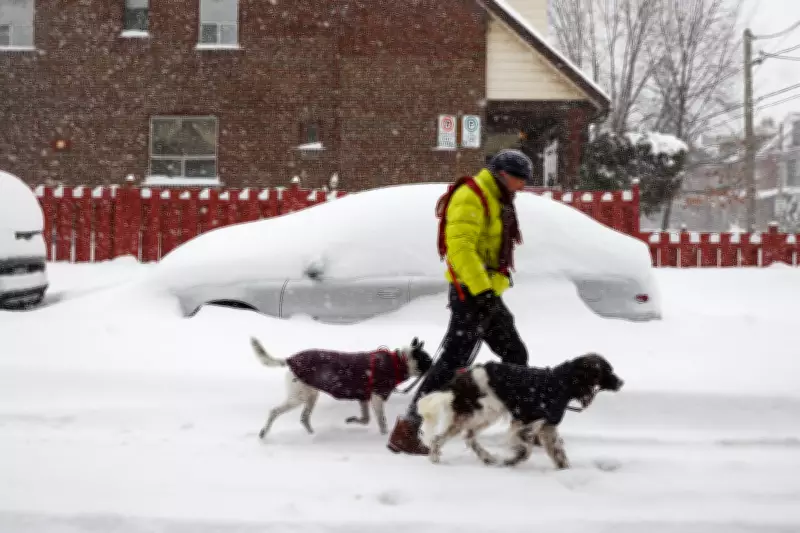
Historical Context: The current forecast recalls Toronto's significant January 2026 storm, documented in Canadian Press photography showing snow-covered vehicles and challenging urban navigation. Such events underscore the importance of heeding weather warnings and municipal guidance during winter emergencies.
Environment Canada continues to monitor the system closely and will update warnings as new data becomes available. Residents should stay informed through official channels and adjust plans accordingly as this winter storm develops.