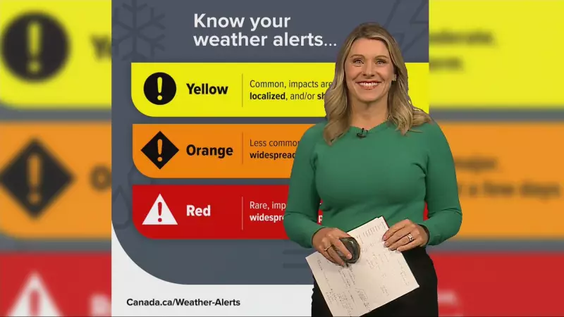
New Alert System Debuts Amid Winter Storm Threat
Environment Canada has chosen a dramatic moment to unveil its revolutionary colour-coded weather warning system, just as snow squalls are forecast to batter southern Ontario from Thursday through Friday. The timing highlights the urgent need for clearer communication during severe weather events that frequently impact the region.
What to Expect from the Approaching Snow Squalls
Meteorologists predict that the Greater Toronto Area will experience what they describe as 'brief bursts' of heavy snow, creating potentially hazardous travel conditions and reduced visibility. These intense but short-duration snow events characterize typical snow squall activity in the region, often catching motorists and residents off guard.
The new warning system comes as Environment Canada seeks to provide more intuitive weather alerts to Canadians. Rather than relying solely on technical terminology, the colour-coded approach aims to make risk levels immediately understandable to the public, similar to systems used in other countries for various environmental hazards.
Broader Weather Impacts Across Central Ontario
Beyond the GTA, Central Ontario faces even more significant accumulation with forecasts indicating powerful snow squalls potentially dropping up to 60 centimetres of snow in some areas. This substantial snowfall could lead to school closures, transportation delays, and increased emergency response needs.
The introduction of the new warning system represents Environment Canada's ongoing effort to improve public safety during extreme weather events. As climate patterns shift and weather becomes increasingly unpredictable, such communication enhancements become critical for community preparedness and response.
Residents across southern and central Ontario are advised to monitor updated forecasts and familiarize themselves with the new colour-coded system to better understand upcoming weather risks and appropriate safety measures.


