Snow Squall Watch Issued for Ottawa as Heavy Snowfall Looms
Environment Canada has issued a snow squall watch for Ottawa, alerting residents to the possibility of significant snowfall in the coming days. The weather agency warns that the capital region could see accumulations of up to 35 centimetres of snow, posing potential hazards for travel and daily activities.
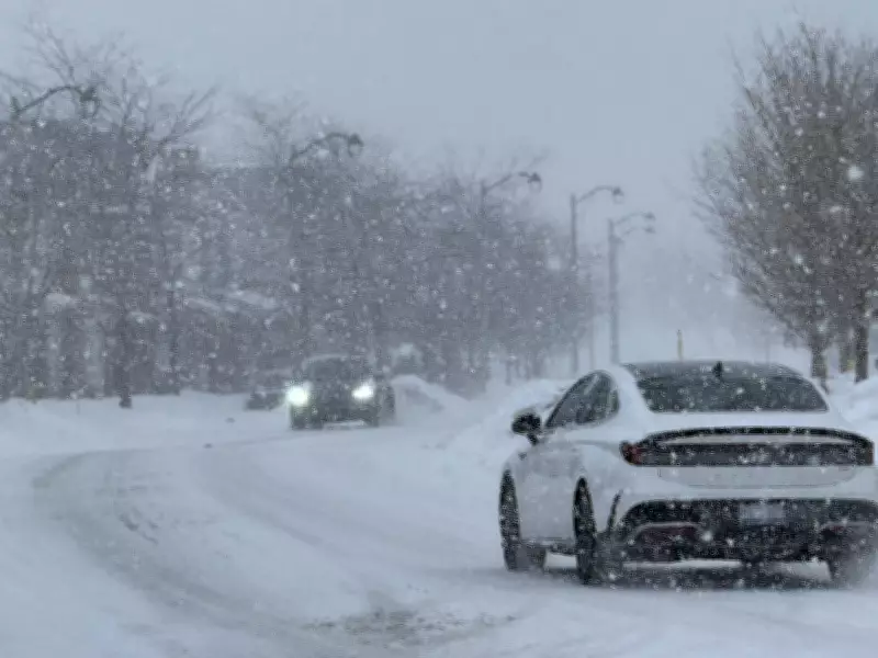
Recent Snowfall Sets the Stage
This alert follows recent winter weather that has already blanketed parts of the city. On Thursday, snow covered residential streets in neighbourhoods like Barrhaven, creating picturesque but challenging conditions. The new watch indicates that more intense snowfall is on the horizon, with squalls capable of reducing visibility and rapidly accumulating snow.
What a Snow Squall Watch Means
A snow squall watch is issued when conditions are favourable for the development of brief but intense bursts of snow. These squalls can lead to:

- Sudden whiteout conditions with near-zero visibility
- Quick accumulation of snow on roads and sidewalks
- Hazardous driving conditions due to slippery surfaces
- Potential disruptions to public transit and school schedules
Residents are advised to monitor weather updates closely and prepare for possible travel delays. Environment Canada recommends having emergency kits ready and considering postponing non-essential trips if conditions deteriorate.
Broader Weather Context in Canada
Ottawa's snow squall watch comes amid varied weather patterns across the country. For instance, Alberta recently saw more than two dozen record temperatures set on Thursday, highlighting the contrasting conditions. Meanwhile, regions like Huron County have experienced blizzard warnings, with locals recounting near-miss incidents due to whiteout conditions.
As winter persists, such alerts underscore the importance of staying informed about local forecasts. Environment Canada continues to monitor the situation and will update warnings as needed to ensure public safety during this snowy period in Ottawa.