
Spring Arrives with a Wintry Blast in Toronto Region
The first day of spring 2026 brought anything but mild weather to the Greater Toronto Area, as residents woke to a messy mix of snow, ice pellets, and freezing rain on March 20. The unseasonable conditions created hazardous travel and highlighted the region's unpredictable seasonal transitions.
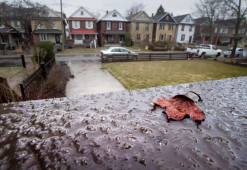
Icy Conditions Disrupt Morning Commute
Freezing rain began coating surfaces across Toronto early in the morning, with ice accumulation reported on railings, roads, and sidewalks. The precipitation started as snow and ice pellets before transitioning to freezing rain, creating slippery conditions that challenged drivers and pedestrians alike.
Environment Canada had issued special weather statements warning of the potential for ice accumulation from freezing rain, particularly in areas north and west of Toronto. The agency noted that while significant ice buildup wasn't expected everywhere, even minor accumulations could make surfaces treacherous.

Historical Context of Spring Freezing Events
This isn't the first time Toronto has experienced freezing rain during what should be spring weather. Similar conditions were documented on April 14, 2018, when ice formed on outdoor surfaces following a late-season freezing rain event. Climate patterns in southern Ontario frequently bring wintry precipitation well into March and sometimes April, despite the calendar indicating spring has arrived.
Meteorologists explain that these events occur when warm air moves over a lingering cold air mass at the surface. The precipitation falls as rain through the warm layer but freezes upon contact with surfaces that remain at or below freezing temperatures.
Safety Concerns and Regional Impacts
The freezing rain created particularly dangerous conditions for morning commuters. Police services across the GTA reported multiple minor collisions as drivers struggled with slippery roads. Transportation officials urged caution and recommended:
- Allowing extra travel time
- Reducing speed on icy roads
- Increasing following distance between vehicles
- Avoiding sudden braking or acceleration
Pedestrians faced their own challenges, with many sidewalks becoming slick with ice. Property owners were reminded of their responsibility to clear walkways to prevent slips and falls.
Broader Weather Patterns Across Ontario
While the GTA dealt with freezing rain, other parts of Ontario experienced different weather phenomena. Central Ontario saw similar mixed precipitation, while regions further north continued to contend with snow. This weather system was part of a larger pattern affecting much of eastern Canada as winter reluctantly loosened its grip.
The timing of this event—on the vernal equinox itself—served as a reminder that meteorological spring doesn't always align with calendar spring in Canada. While daylight hours begin to exceed nighttime hours, temperatures can remain wintry for weeks after the official start of the season.
Looking Ahead to Spring Weather
Despite the icy start, forecasters expect more typical spring conditions to develop in the coming weeks. Temperature trends generally show gradual warming through late March and April, though occasional cold snaps and wintry precipitation remain possible through early April.
Residents are advised to remain prepared for variable conditions during this transitional period, keeping winter gear accessible even as they anticipate the warmer days ahead. The region's climate typically sees the last measurable snow in early April, with consistent above-freezing temperatures becoming more common as the month progresses.


