Environment Canada has lifted all severe thunderstorm warnings for Toronto and the Greater Toronto Area after a line of storms passed through the region on Wednesday evening. The storms brought heavy rain, strong winds, and frequent lightning, but no major damage has been reported so far.
Warnings Issued for Wednesday Evening
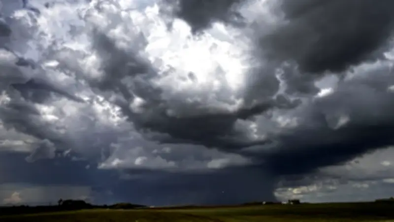
The warnings were initially issued shortly before 5:40 PM EDT on July 1, 2026, as meteorologists tracked a cluster of thunderstorms moving eastward across southern Ontario. The affected areas included Toronto, Mississauga, Brampton, Hamilton, and surrounding municipalities. Environment Canada advised residents to take cover immediately as the storms approached, warning of possible hail, damaging winds, and torrential downpours.
According to Environment Canada, the storms were fueled by a hot and humid airmass that had settled over the region earlier in the day, with temperatures reaching into the low 30s Celsius. The instability led to rapid thunderstorm development along a cold front sweeping through the area.

Impact on Canada Day Celebrations
The storms occurred on Canada Day, disrupting some outdoor festivities and fireworks displays. In Toronto, Nathan Phillips Square saw a temporary evacuation as lightning moved within range of the venue. Organizers of the city's main Canada Day celebration delayed the evening fireworks by approximately 30 minutes until the storms passed. Similar delays were reported in Mississauga and Brampton, where local officials urged residents to seek shelter.
In Ottawa, separate storms earlier in the day dumped 90 mm of rain, flooding roads and knocking out power to thousands of homes. Hydro Ottawa reported that crews were working to restore electricity to affected neighbourhoods. The storm system also prompted a severe thunderstorm watch for Montreal, with the risk of wind gusts, hail, and even a tornado.
Heat Dome Continues Across Canada
The thunderstorms are part of a broader pattern of extreme weather gripping much of the country. A heat dome has settled over central and eastern Canada, with heat warnings in effect for parts of Ontario, Quebec, and the Maritimes. Environment Canada meteorologist David Phillips explained that the heat dome is trapping hot air near the surface, leading to record-breaking temperatures and unstable conditions that spawn severe storms. “We’re seeing a classic setup where the heat and humidity build during the day, then release in the form of violent thunderstorms in the evening,” Phillips said.
In Alberta, Calgary’s Canada Day celebrations also faced a storm risk, though the city avoided the worst of the weather. Premier Danielle Smith used the occasion to deliver a message of unity and optimism, while noting the challenges posed by the extreme weather.
Other Weather-Related Incidents
In Winnipeg, a storm in the Whyte Ridge neighbourhood was confirmed as a tornado, and the rating of a previous tornado in Rossburn was upgraded by Environment Canada. No injuries were reported in either event. Meanwhile, in northeastern Ontario, hundreds of residents remained without power as a severe thunderstorm watch continued amid the heat.
The storms also contributed to tragic incidents on the water. Ontario Provincial Police charged an impaired boater in connection with a drowning near Peterborough, though details of the case remain under investigation.
As the severe thunderstorm warnings end, residents are advised to stay alert for further updates from Environment Canada and to monitor local forecasts as the heat dome persists into the weekend.