Residents along British Columbia's South Coast, including Metro Vancouver, are being urged to prepare for potential flooding this weekend. Federal meteorologists have issued a special weather statement warning that a combination of abnormal high tides and a low-pressure weather system could lead to moderate coastal flooding, with the highest risk expected on Sunday, January 4, 2026.
Areas Under the Flood Alert
The coastal flooding alert covers a significant portion of the region. On the mainland, it includes Vancouver, the Musqueam First Nation lands, South Surrey, Tsawwassen, and Boundary Bay. The warning extends across the Strait of Georgia to Vancouver Island, encompassing the Southern Gulf Islands, Greater Victoria, and much of the island's western and eastern shorelines.
Environment and Climate Change Canada cautions that water levels are forecast to exceed the highest astronomical tides. The falling atmospheric pressure associated with the incoming system will act like a suction effect, further elevating coastal water levels beyond the already high predictions. This creates an increased risk for flooding in vulnerable areas.

Potential Impacts and Hazards
The federal agency outlines several concerns for shoreline communities. Minor to moderate coastal flooding is likely along exposed, low-lying areas. The situation could be exacerbated where onshore winds coincide with the peak high tides, potentially leading to locally significant flooding.
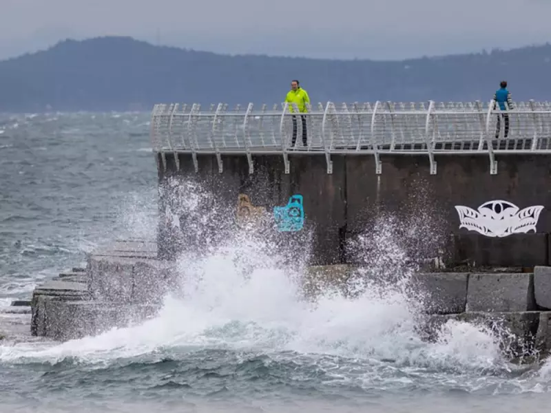
In addition to flooding, the conditions pose other risks. Moderate winds and storm surge may cause erosion and wash debris onto coastal roads and properties. The public is advised to stay away from shoreline trails, beaches, and breakwaters during the alert period due to dangerous conditions.
Weekend Weather Forecast Across B.C.
For Metro Vancouver, Saturday is expected to bring rain and wind, setting the stage for the flooding threat. Forecasters predict up to 15 millimetres of rain with wind gusts reaching 40 km/h. The wet and windy conditions are expected to intensify overnight and continue into Sunday.
Meanwhile, a separate weather hazard is unfolding in the province's interior. A freezing rain alert is in effect for Saturday morning in the southern B.C. Interior, including the South Okanagan, Boundary, and West Kootenay regions. The agency warns that higher elevation areas between 600 and 1,500 metres, such as sections of Highway 3, could see significant impacts from the ice.
Roads and walkways are expected to become icy and slippery, with black ice posing a particular danger as it can be difficult to see. The freezing rain is forecast to change to rain mixed with snow by Saturday afternoon as temperatures slowly rise.
This dual threat of coastal flooding and interior freezing rain underscores a volatile start to the new year for British Columbians, prompting officials to advise caution and preparedness.