Tropical Cyclone Arthur, now weakened to a low pressure area, continues to menace the upper Texas coast with relentless rainfall and flooding. The storm, which initially formed in the Gulf of Mexico, has left a trail of waterlogged communities and raised concerns about further inundation.
Storm Path and Impact
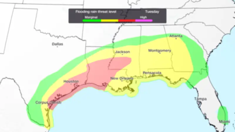
Arthur's remnants are drifting slowly along the coast, dumping heavy rain on areas already saturated from previous storms. The National Weather Service has issued flood watches and warnings for several counties, urging residents to stay alert. Rainfall totals could reach up to 10 inches in some locations, leading to flash flooding and rising river levels.
Community Response
Local authorities have set up sandbag distribution points and are monitoring levees and drainage systems. Emergency shelters are on standby for those who may need to evacuate. In Houston, officials are reminding residents to avoid driving through flooded roads and to heed evacuation orders if issued.

“We are watching the situation closely and are prepared to act if conditions worsen,” said a spokesperson for the Texas Division of Emergency Management. “The key is for everyone to stay informed and take necessary precautions.”
Broader Weather Context
Arthur's lingering effects are part of a larger pattern of unsettled weather across the southern United States. The storm's slow movement is due to weak steering currents, allowing it to stall and dump excessive rain. This has raised concerns among meteorologists about the potential for a prolonged flooding event.
Residents along the coast are urged to monitor local forecasts and have an emergency plan in place. The storm serves as a reminder that even weakened tropical systems can pose significant hazards.