

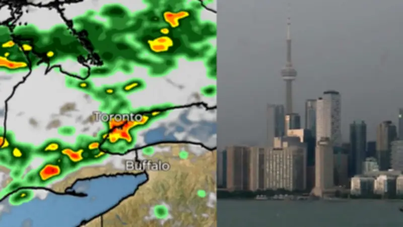
Environment Canada has lifted thunderstorm warnings for Toronto but continues to keep the city under a severe thunderstorm watch as a major weather system moves through the region. The storm, which rolled into Toronto on July 9, 2026, brought heavy rain and damaging winds, prompting officials to monitor conditions closely.
Storm Timeline and Impact
The severe thunderstorm watch remains in effect as of the afternoon of July 9, with meteorologists warning that conditions could still produce strong winds, hail, and torrential downpours. A timelapse video captured the massive thunderstorm rolling into the city, showing a dramatic shift in the skyline as dark clouds engulfed the area. Residents reported sudden drops in temperature and reduced visibility as the storm intensified.
Environment Canada initially issued warnings for parts of the Greater Toronto Area, but those were later downgraded to a watch as the storm's core moved eastward. However, officials caution that isolated severe thunderstorms remain possible into the evening. “We’re not out of the woods yet,” said a meteorologist from Environment Canada. “The watch means conditions are favourable for the development of severe thunderstorms that may produce damaging wind gusts, large hail, and heavy rain.”

Widespread Effects Across the Region
The storm caused localized flooding in low-lying areas, with reports of water pooling on major roads and highways. Toronto police advised drivers to exercise caution and avoid flooded underpasses. Power outages were reported in several neighborhoods, though hydro crews were working to restore service. The storm also disrupted outdoor activities and public transit, with some GO Transit services experiencing delays due to debris on tracks.
In addition to Toronto, surrounding municipalities such as Mississauga, Brampton, and Vaughan were also under the watch. The system is part of a broader weather pattern affecting southern Ontario, with multiple rounds of thunderstorms expected throughout the day. “This is a dynamic situation,” the meteorologist added. “We urge everyone to stay alert and monitor alerts from Environment Canada.”
Safety Precautions and Outlook
Environment Canada recommends that residents take shelter immediately if threatening weather approaches. The agency also advises securing loose objects outdoors and avoiding water-related activities due to the risk of lightning. As of late afternoon, the watch was expected to remain in effect until at least 8 PM EDT, with conditions gradually improving overnight.
The storm's arrival comes after a period of hot and humid weather in Toronto, with temperatures reaching into the high 20s Celsius earlier in the week. The cold front associated with the thunderstorms is expected to bring cooler and drier conditions for the weekend. No injuries have been reported in connection with the storm, but officials continue to monitor for any damage or emergencies.